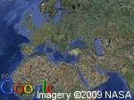
If you are just looking to display a satellite map image for a specific latitude longitude (without the google maps panning/zooming etc), then you should check out Google Static Maps.
You just need to build a URL string, then make an HTTP request (from your java implementation) for the image (in whatever format you like). You can specify a whole bunch of parameters in the URL to get the satellite image you are after:

From the URL:
http://maps.google.com/staticmap?center=40,26&zoom=1&size=150x112&maptype=satellite&key=ABQIAAAAgb5KEVTm54vkPcAkU9xOvBR30EG5jFWfUzfYJTWEkWk2p04CHxTGDNV791-cU95kOnweeZ0SsURYSA&format=jpg
EDIT: Ok, I actually deleted this answer because I discovered section 10.8 in the TOS explicitly forbids accessing static maps from outside a browser. But then I discovered this FAQ update which seems to allow it. I might ask a Google person and get the final word.
EDIT: Thanks Paracycle, not sure if that is a new addition to the FAQ, but in any case it is pretty explicit, you are not allowed to do this.